France Weather Forecast: A Mixed Bag for the Weekend of September 20-21, 2025
France’s coastlines are set for a weekend of contrasting weather conditions from September 20th to 21st, 2025. While some regions will enjoy sunshine, others should prepare for strong winds and potential storms. Here’s a detailed breakdown to help you plan your weekend activities safely.
English Channel: Saturday is Your Best Bet
Saturday looks promising for beachgoers. Expect temperatures between 15°C and 21°C. The sky will be partly to very cloudy, with showers possible in the afternoon in Brittany and Lower Normandy. Thunderstorms are expected to hit the Opal Coast in the late afternoon. The UV index will range from 3 to 4. Morning walks are recommended before the showers arrive.
At sea, a south wind of force 3 to 4 will strengthen to southwest force 6 to 7, with gusts reaching 43 knots. The sea will be slight to rough, becoming very rough in northern Brittany and the Iroise Sea. Caution is advised for navigation, especially for smaller boats.
Sunday will be noticeably cooler, but with returning sunshine and temperatures ranging from 13°C to 17°C. The water temperature will remain pleasant, around 17°C. Expect a mix of sunshine and clouds, with possible showers in the late afternoon. Visibility will be excellent. The wind will shift from southwest force 5 to 6 to northwest force 3 to 4, with gusts reaching 41 knots in Brittany in the evening. The sea will be rough, becoming calmer. Conditions will be more favorable for sailing, but stay alert for gusts.
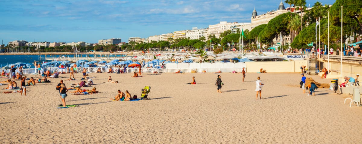
Atlantic Coast: Enjoy Saturday, But Watch for Storms
Saturday on the Atlantic beaches will see temperatures between 16°C and 21°C, feeling as warm as 25°C. The sky will be partly to very cloudy, with a risk of thunderstorms. The UV index will be between 3 and 5. Make the most of the sunny spells for walks and swimming.
At sea, the wind will shift from south to southwest force 3 to 5 to west to west-northwest force 5 to 6, with gusts up to 36 knots. The sea will be slight to rough, becoming very rough between Loctudy and Lorient. Navigation conditions will be tricky, especially for inexperienced sailors.
Sunday will bring cooler temperatures, from 14°C to 17°C. The sky will remain very cloudy with some sunny spells, and frequent showers, sometimes thundery, are expected. Visibility will be good to excellent.
At sea, a west to northwest wind of force 3 to 5 will blow with gusts up to 23 knots. The sea will be rough to fairly rough. Sailors should be cautious of the thundery showers.
Mediterranean: Sunday Sees a Turn for the Worse
Saturday will be summery on the Mediterranean beaches, with temperatures from 22°C to 25°C. The sky will be clear to partly cloudy, improving throughout the day. Visibility will be excellent, except from Port la Nouvelle to Port Camargue where it will be poor due to misty clouds from the sea. The UV index will be high, between 6 and 7, so protect yourself. The sea temperature remains very pleasant, between 23 and 25°C depending on the beach.
At sea, an east-southeast to southeast wind of force 3 to 5, locally force 6 on Lion, will blow with gusts reaching 30 knots on the Languedoc-Roussillon coast. The sea will be slight to fairly calm, becoming fairly rough from Cerbère to Port la Nouvelle. Conditions are ideal for sailing, but be aware of the sea breeze.
Sunday will be fine in the east of the basin, while the sea breeze will freshen with the arrival of storms in Occitanie. Temperatures will climb to 29°C in the Bouches de Bonifacio. The sky will be very cloudy with a risk of storms, especially from Cerbère to Port Camargue. Showers with possible gusts are expected. Visibility will be poor to excellent, reduced by mist on the edge of the Gulf of Lion.
At sea, an east-southeast to southeast wind of force 2 to 5, locally force 6, will blow with gusts reaching 31 knots. The sea will be fairly calm, becoming fairly rough from Port Camargue to Marseille. The strengthening storm conditions in the afternoon require increased vigilance for all water activities.
In Summary
This last summer weekend before autumn on Monday will be typical of the season, marking a stormy and windy transition that should be treated with caution.
Enjoyed this post by Thibault Helle? Subscribe for more insights and updates straight from the source.